
Unlocking Insights: The Transformative Power of Remote Sensing Technology
The Power of Remote Sensing in Modern Science
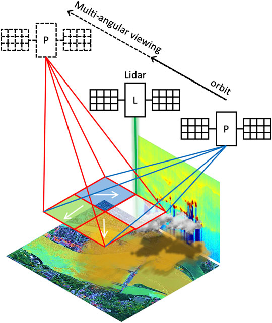
Remote sensing, a technology that allows the observation of Earth and its atmosphere from a distance, has revolutionized various fields of science and research. By using sensors on satellites, aircraft, drones, or ground-based platforms, remote sensing provides valuable data and insights that were previously inaccessible.
One of the key applications of remote sensing is in environmental monitoring. Scientists can track changes in land use, deforestation, urban sprawl, and natural disasters from a bird’s eye view. This data is crucial for conservation efforts, disaster response planning, and understanding the impact of human activities on the environment.
In agriculture, remote sensing plays a vital role in crop monitoring and management. By analysing satellite imagery and other remote sensing data, farmers can optimize irrigation, fertilization, and pest control strategies to improve crop yields and reduce environmental impact.
Remote sensing also contributes to weather forecasting by providing real-time information on atmospheric conditions. This data is used by meteorologists to predict weather patterns more accurately, leading to better preparedness for extreme events such as storms, hurricanes, and heatwaves.
In archaeology and cultural heritage preservation, remote sensing techniques like LiDAR (Light Detection and Ranging) have enabled researchers to uncover hidden archaeological sites and map ancient structures with high precision. This non-invasive approach helps protect valuable cultural assets while advancing our understanding of past civilizations.
Furthermore, remote sensing has proven invaluable in disaster management and response. During natural disasters such as earthquakes, floods, or wildfires, satellite imagery can quickly assess the extent of damage and aid in rescue operations by identifying affected areas that are difficult to access on the ground.
As technology continues to advance rapidly, the capabilities of remote sensing are expanding. From monitoring climate change impacts to tracking wildlife populations and mapping urban growth trends, the applications of remote sensing are diverse and far-reaching.
In conclusion, remote sensing is a powerful tool that enhances our ability to study Earth’s systems comprehensively. By harnessing the wealth of data provided by remote sensing technologies, scientists can address global challenges more effectively and make informed decisions for a sustainable future.
Exploring Remote Sensing: Understanding Its Mechanisms and Diverse Applications
- What is remote sensing and how does it work?
- What are the applications of remote sensing in environmental science?
- How is remote sensing used in agriculture and crop monitoring?
- What role does remote sensing play in weather forecasting?
- How is remote sensing applied in archaeology and cultural heritage preservation?
What is remote sensing and how does it work?
Remote sensing is a technology that enables the collection of information about Earth’s surface and atmosphere from a distance, typically using sensors on satellites, aircraft, drones, or ground-based instruments. It works by detecting and recording electromagnetic radiation reflected or emitted by the Earth’s surface. Different objects and materials reflect or emit varying amounts of radiation based on their properties, such as composition, texture, and moisture content. By analysing this data, remote sensing can create images and maps that provide valuable insights into land cover changes, environmental conditions, weather patterns, and more. This technology plays a crucial role in various fields including environmental monitoring, agriculture, disaster management, archaeology, and urban planning.
What are the applications of remote sensing in environmental science?
Remote sensing plays a crucial role in environmental science with diverse applications that contribute to understanding and managing the Earth’s ecosystems. One key application is monitoring land use and land cover changes, which helps in assessing deforestation, urbanization, and habitat loss. Remote sensing also aids in mapping and monitoring natural disasters such as wildfires, floods, and landslides, enabling timely response and mitigation efforts. Additionally, it assists in assessing air and water quality by detecting pollutants and monitoring environmental impacts of human activities. Overall, remote sensing in environmental science provides valuable data for conservation, resource management, climate change studies, and sustainable development initiatives.
How is remote sensing used in agriculture and crop monitoring?
Remote sensing plays a crucial role in agriculture and crop monitoring by providing valuable insights and data for farmers and researchers. Through satellite imagery, drones, and other remote sensing technologies, agricultural professionals can monitor crop health, detect pests and diseases, assess soil moisture levels, and optimize irrigation practices. By analysing the spectral signatures captured by remote sensors, farmers can identify areas of stress within their fields and take targeted actions to improve crop productivity. This real-time monitoring capability allows for more efficient resource management, leading to higher yields, reduced environmental impact, and ultimately contributing to sustainable agricultural practices.
What role does remote sensing play in weather forecasting?
Remote sensing plays a crucial role in weather forecasting by providing essential data on atmospheric conditions from a wide spatial perspective. By using satellites equipped with sensors to capture information such as temperature, humidity, cloud cover, and wind patterns, meteorologists can gather real-time data to analyse and predict weather phenomena accurately. This remote sensing data enables meteorological agencies to generate more reliable forecasts, improve early warning systems for severe weather events, and enhance overall preparedness for potential weather-related hazards. The integration of remote sensing technology into weather forecasting processes has significantly advanced our ability to understand and predict complex weather patterns, ultimately contributing to more effective disaster management and mitigation strategies.
How is remote sensing applied in archaeology and cultural heritage preservation?
Remote sensing plays a crucial role in archaeology and cultural heritage preservation by providing valuable insights and data without disturbing the sites. Techniques such as LiDAR (Light Detection and Ranging) allow researchers to create detailed 3D maps of archaeological sites, uncover hidden structures, and identify subtle landscape features that may indicate the presence of buried artefacts. Satellite imagery helps archaeologists monitor site changes over time, track illegal activities like looting, and plan conservation efforts effectively. By using remote sensing technologies, archaeologists can explore and protect cultural heritage sites with precision and efficiency, contributing to a better understanding of our past while safeguarding these valuable assets for future generations.